-40%
Tom Harrison Maps Mono Divide High Country Trail Map High Sierra & IL MI Canal
$ 5.28
- Description
- Size Guide
Description
Tom Harrison MapsThis map shows all the High Sierra country bounded by Huntington Lake, South Lake, and Cascade Valley. It shows hiking trails, campgrounds, group camps, RV camps, and pack stations. Printed on waterproof and tear resistant material.
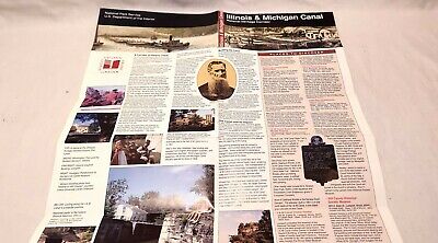
Used but in excellent clean condition. Also a Illinois & Michigan Canal National Heritage Corridor map with roads, trails, and points of interest. Paper map, clean but does have a slight tear in the cover.
Please contact me for additional payment options or for any questions. All items are from a clean, smoke free household. Photos in the listing are of the actual item. Items will be well packed and shipped fast, USPS Tracking will be provided. I will combine items to save on shipping whenever possible, local pickups are welcome.


